2011/Taiwan/Hualien City
Hualien County |
|
County seat |
|
Region |
Eastern Taiwan |
County Magistrate |
Fu, Kun-Chi (傅琨萁) |
Cities |
1 |
Townships |
12 |
Area |
|
- Total |
4,628.57141 km² |
- % water |
1.0 % |
Population |
|
- Total |
340,794 (March 2010) |
- Density |
73.63/km² |
Symbols |
|
- County flower |
Lotus (Nymphaeaceae) |
- County tree |
Peepul (Ficus religiosa) |
- County bird |
Maroon Oriole (Oriolus traillii) |
Official websites |
|
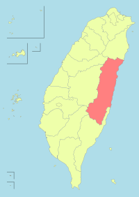
Hualien County (Chinese: 花蓮縣) is the largest county in Taiwan and is located on the mountainous eastern coast of Taiwan. It contains the island's largest port. It is the starting point of the Hualien-Taitung Line and the terminal point of North-Link Line of TRA. For the Provincial highway System, Hualien has the connection of Suhua Highway, Huatung Highway, Hualien-Taitung Coast Highway and the Central Cross-Island Highway. Hualien County also contains part of Taroko National Park and Yushan National Park.
(source:Hualien)
Teams
Please add links to your team(s) name here:
(The idea of adding another team page is that there may be more than one team in a region/city)
Create a new Team page:
In all cases you need to keep the CategoryCity2011 to allow your city to be listed!
